
Norway
Norway This mountainous part of the Scandinavian peninsula where the ocean carved immense fjords in the land and glaciers cover the mountaintops. Where in the winter darkness reigns and in the summer the sun never sets.
dated 2020 until 2023
(click on an image to enlarge an artwork)
send a message
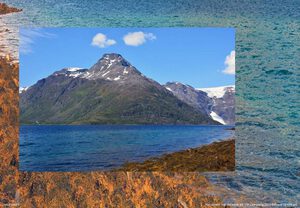
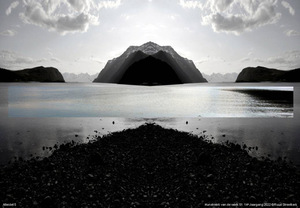
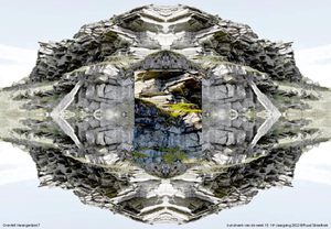
Jøkelfjord 9
2023Jøkelfjord is a fjord in northern Norway. This is where the Øksfjordjøkelen debouches, the 8th largest glacier on the Norwegian mainland and the only one of which the ice tongue reaches into the sea. The glacier covers an area of approximately 43 km² and the highest point is 1,204 m above sea level. This is also the highest point of the Norwegian province of Finnmark.
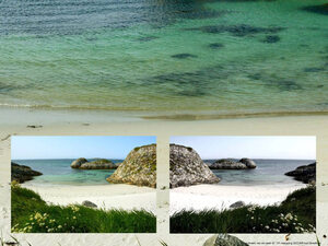
Andenes 5
2023The village of Andenes lies on the northern tip of the island Andøya, part of the Lofoten archipelago in Norway. It was already an important fishing village during the iron age. By the beginning of the 20th century it was one of the largest fishing ports of Norway. On the west side of the village are small coves with beautiful blue water and white sandy beaches, that look as if one has arrived in a tropical area. But no, this place lies far north of the Arctic Circle, facing the North Atlantic, from where an ice cold, strong wind is blowing inland ....

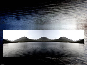
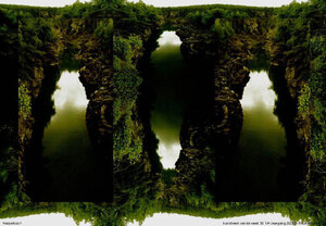
Djupvatnet 1
2023One gets on this plateau through a long tunnel. It is crisp and cool, a large sheet of ice stretches out before us, the last snow covers the mountain slopes. In the heat of the sun, after all it is June already, the ice is melting, so ice-floes drift in the cold water
Børvasstindan 5
2023Børvasstindan is the name of the massif south of the town of Bodø in Norway. 'Tind' means tooth in Norwegian. The various peaks of this chain of mountains are about 1000 meters high. Nearby is another point of interest: the world's strongest tidal current, the so-called 'Saltstraumen'. In the course of about six hours 372 million cubic metres of sea water is squeezed through a 150 meters wide and 31 meter deep passage in- or out of the fjord, with a flow rate of approximately 40 km per hour.
Andøya 9
2022Andøya is an island in the Vesterålen archipelago in the County Nordland in Norway. This archipelago is located directly north of the Lofoten and northwest of the port of Narvik on the mainland. With an area of 489 km², Andøya is the ninth largest island in Norway. From Andenes on its northern tip, boat trips are organized to spot Sperm Whales.
Alteidet 5
2022Alteidet is a small coastal village in Lapland in the far north of Norway. This former trading post on the Little Altafjord, a branch of the Kvaenangenfjord, is located on a wooded isthmus about 50 km west of the town of Alta. The name Alteidet is a combination of Alta and eidet (= isthmus). There are about 130 residents living in the area. Nowadays, the European route E6 runs along Alteidet.
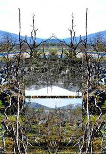
Harpefoss 1
2022Harpefoss is a rapid in the Gudbrandsdalslågen river, near the municipality of Sør-Fron, Norway. The water is very calm here, but Norwegian rivers 'crest' in the spring when the snow melts. The Gudbrandsdalslågen, which drains higher elevations and is fed mainly by glaciers, usually has this high-water moment later than the Glomma River, which drains the water from eastern valleys. In the rare year when both crest at the same time, their confluence at Nes is the site of major flooding. The most famous simultaneous crest of both rivers resulted in a flood on 20/23 July 1789, with peaks of more than 50 feet above average level and a lot of damage in the vicinity of Nes, with 68 casualties.
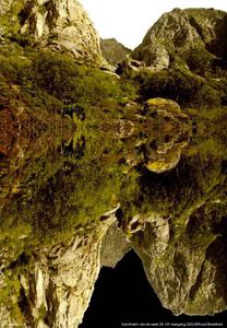
Festvantind 3
2022This mountain is located near the bridge that leads to the fishing-village of Henningsvær, in the municipality of Vågan in Nordland County, Norway. The village has an area of 0.31 km² and is located on the southernmost tip of the island of Austvågøy, part of the Lofoten Archipelago. Actually, it consists of a number of small Skerries that are connected by bridges. The image of the Lofoten is mainly dominated by wooden racks with cod-fish hanging to dry and red fishermen's cabins on stilts in the harbors. The archipelago has been known for centuries for its rich fishing tradition. In the middle of winter, the ships set sail to catch the fish in a few months. These rich fishing grounds are due to the Warm Gulf Stream around the islands, in which the fish have their spawning-grounds. No oil drilling is permitted around these spawning-grounds.
Ivguvuotna 4
2022Ivguvuotna 4 At 350 kilometers north of the Arctic Circle, we overlook the waters of the Lyngenfjord, or as it is called in Sami: Ivguvuotna. This fjord is 82 kilometers long and therefore the longest in the Norwegian province of Troms. In the southern tip it ends at the village of Storfjord, after which the first part of the fjord is named, and it reaches as far as the island of Uløya towards the north. On the west bank one has a fine view of the Lyngen Alps that form the peninsula between the Ullsfjord and the Lyngenfjord.
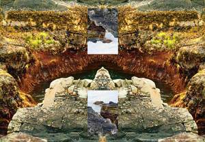
Gravfelt Varangerfjord 7
2022In the far northeast of Norway lies the Varangerfjord. It is about 100 km long and with an average width of 70 km. At Kirkenes, the Pasvik River, which forms the border with Russia, debouches in the fjord. The Varanger peninsula is washed in the north by the Barentsz Sea. On the prehistoric coastline near Mortensnes, traces of pit-dwellings and tentpoles have been found from the Neolithic- and Early Bronze Age. There is also a large, pre-Christian burial field dating from around 1000 BC to the 16th century. The burial field contains more than 400 graves in stone cavities. In addition, there are several sacrificial sites, such as the Tran-steinen (Tear-stone) sacrificial site, which was smeared with cod liver oil by fishermen to ensure good luck when fishing.
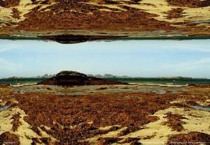
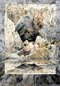
The coast of Sandfjorden 7
2021In ice-cold weather we are driving along the Sandfjorden, a bay on the Varanger peninsula in Norway, on our way to Berlevåg, one of the northernmost ports of Europe. In the inner part of the bay, where the Sandfjord River flows into the Barents Sea, stretches a kilometer-long sandy beach. But on the rocks seaweed has settled. The brown and bright green of the weed forms a beautiful color palette with the rocks, which turn from dark green on the wet parts into a lighter sand color when dried up by the sunlight. It strikes us as a surprising contradiction, all these colors in a frosty cold environment.
Fjukstad 10
2021We are here on one of the Vikna Islands in Northern Norway. This is a large archipelago off the northwest coast of Trøndelag county, with some 6,000 larger and smaller islands, far into the Norwegian Sea. Today bridges connect the islands. Vikna is the largest spawning area for cod south of the Lofoten. Here lie huge whale bones, found by the inhabitants, proving that the wear and tear of time is doing its job.
Goahtemuorjohka 2
2021The Goahtemuorjohka is a river in northern Norway. Along the northwest coast lie high mountains and deep fjords, with short and straight rivers, typical for large parts of the Norwegian coast. We are here near the timber-line where the birch trees are small in size, but nevertheless very old.
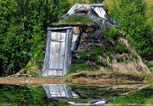
Biltoskogen 1
2021In a remote spot in northern Norway we discover a Goahti or peat hut, a traditional winter residence for the Sámi. This Goahti has a wooden frame and is lined with peat moss. A fabric-covered goahti is very similar to a circular Sámi tepee, the so-called Lavvu, but is often constructed slightly larger. When the shape is a bit more elongated, the goahti in that tent-version is also called a 'bread-box lavvu’
Sandfjorden coast 5
2021We are here in a bay on the Barents Sea, on the north coast of the Norwegian Varanger Peninsula, near the fishing port of Berlevåg. The boats of the Hurtigroute pass here and the village has an airport. Its main industries are fishing and fish processing. When the Germans withdrew here at the end of World War II, they applied 'burning earth' tactics and burned down all buildings in the village. The rocks along this coast show that not too long ago sea ice covered the coast during a great part of the year. This is probably no longer the case today, due to global warming.

Älgafallet
2021With its height of 46 m, this is the highest waterfall in the Swedish region of Bohuslän. The waterfall is located right on the Norwegian border. Hereafter the water flows into the Idefjord via the Enningdalsälv River. According to historical sources, in the late 14th century, during a hunt, 17-year-old Norwegian King Olaf IV fell from the threshold of the waterfall and did not survive. There used to be a mill and a sawmill at the foot of the waterfall, but nowadays nothing of that is to be seen.
Lákkojohka 5
2020The river Lákkojohka (Sami) or Langfjordelva (Norwegian) rises on the vast and watery Ifjordfjellet in the far north of Norway, a plateau that is grazed by many reindeer. The river's lush main valley runs northeasterly into the Langfjord, one of the arms of the Tanafjord. By deposition of several tributaries, large parts of the wide valley are covered by river plains. The valley is uninhabited, apart from a few permanent residents at the mouth. What struck me here was the variety of colorful stones in the river!
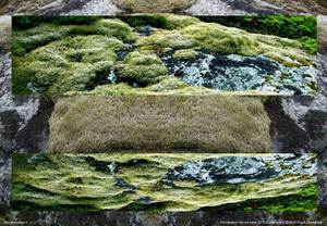
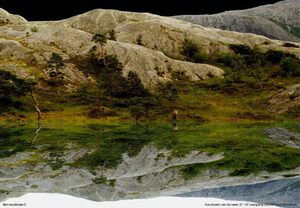
Lichens 3
2020This lichen is called Map Lichen (Rhizocarpon Geographicum), a lichen that grows on quartz. Lichens are sensitive to air pollution and their presence or absence is used as an indicator. For example some types of lichen fade away in areas where the concentration of sulphur dioxide (SO2) is high. Beard mosses and bush-forming lichens in particular turn out to be very sensitive to air pollution, crustaceous lichens seem less susceptible. In the 1960s and 1970s, due to air pollution, the number of species of epiphytic lichen had diminished so much in large parts of the Netherlands, that these areas were referred to as 'epiphyte deserts'.
Atnbrua 3
2020Near these rapids in the River Atna in Norway, settlements from the Stone Age were discovered on the banks. The Atna has formed a few small lakes in its catchment area, only the Atnsjøen is considerably larger. The average depth of this lake is 35m and 80m at its deepest point. About 1,500 tons of erosion material are supplied annually by the river, most of which is deposited as a delta at the lake's inlet. The lake is relatively poor in nutrients, yet there it contains a lot of trout and salmon trout, as well as grayling further downstream .
Boat Hjemmeluft 1
2020This is a part of an old fishing boat on the grounds of the Alta Museum in the far north of Norway. The long Altafjord connected the coast with the inland and was an important traffic-artery with a history that stretches over 5000 years, as witnessed by the large amount of petroglyphs made here. This place, Hjemmeluft, is now a World Heritage site. On either side of the bay, besides remnants of prehistoric settlements, some 3000 petroglyphs with a wide variety of motifs and scenes can be viewed via a 3 km long foot-bridge system. Hunting and fishing are central themes, as this was the basis of life for the inhabitants at the time. For example (as a top 5) the hunting of wild reindeer, bears and elk, whaling and halibut fishing are depicted. In addition, we find images of seabirds, dogs, wolves, foxes, hares and of course humans, but also various objects, tools and boats of all shapes and sizes. Today the petroglyphs are found 8m to 25m above sea level, but when they were made, they were located down below in the beach zone, where vegetation-free rocks were near to the sea. Due to the upward movement of the earth after the Ice Age, new rock surfaces still rise from the water.